Flight Radar – the easiest way to track flights. In the age of information, there’s no reason why you should ever be kept in the dark about anything. That includes information on planes, flight routes, take-off and landing times and all kind of other details related to flying. Flight Radar lets you access information on flight traffic in real time. All you need is an internet connection and a smartphone or notebook, and you’re ready to track flights live on radar. Let us show you what Flight Radar can do and how you can easily track flights yourself.
What is a Flight Radar?
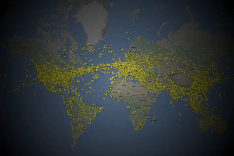
All flights and flight movements around the world are captured by radars (e.g. “flightradar24“). As they pass through the air, radar waves hit planes, helicopters, drones and other flying objects in their path and bounce back. The distance from the wave transmitter to the “impact” can be measured and used to precisely locate these objects. When these location data are placed on a map and the whole thing is digitised, the result is a Flight Radar.
Of course, a single radar wave transmitter isn’t capable of detecting every flight around the globe. But if you combine data from radar receivers around the world, you’ll have a complete image of all flight movements. This image can be formatted as a map, so that all the planes currently in the air can be displayed on one screen. This image can then be uploaded to the Internet to create the Flight Radar presented on our website.
Where do the Flight Radar data come from?
Up until the end of the twentieth century, Flight Radar was only available to professionals. These were primarily civil aviation workers, who would be posted in airport flight towers and flight traffic control centres, making sure that flight traffic in their areas ran properly. Flight Radar systems were also used by members of the military. Like their counterparts in civil aviation, they were responsible for conducting air traffic.
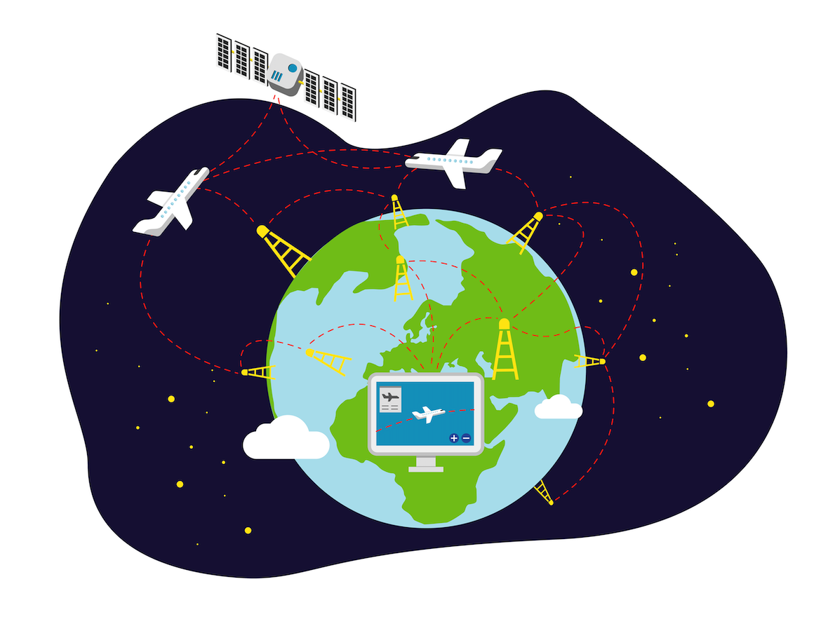
As air transport became more and more significant, so did radar. The number of flight to be monitored is continuously increasing. So the expansion of the radar system was also an important step in the development of aviation. Radar systems were installed in more and more locations world-wide. Since each of these systems can only monitor one section of air space and many flights are international, it was necessary to network, share and coordinate data. So air traffic controllers make the data available.
Over the years, especially since the appearance of the Internet in nearly every household and in nearly every pocket, tech-savvy users have begun making flight traffic information and data available to the general public. These efforts have produced a variety of Flight Radar applications. Today, these applications are available to anyone with an Internet connection. No matter where you are in the world, anyone with a smartphone or a PC has the potential to access available Flight Radar data.
Who is Flight Radar useful to?
Nowadays, all types of users benefit from the ability to pull up a Flight Radar.
- Regulatory agencies (military and civil) still use Flight Radar to regulate air traffic.
- Private individuals wishing to check up on a loved one’s flight can access data on specific flights.
- Drone pilots are responsible for ensuring that their devices do not interfere with air traffic and should use radar to look up flight routes.
- Anyone considering relocating or moving to a new apartment can use a Flight Radar to check if flight noise might be an issue in their new neighbourhood.
- Holidaymakers can look up their flight number for a sneak-peek at their flight route. If a flight takes place during the day and the route takes you through an interesting region, for example, then it might be a good idea to pick a seat with a view.
These are just a few examples of Flight Radar users.
One thing’s for certain – nowadays, pretty much everyone is affected by air traffic or will be at some point. That’s why it’s important that radar data be available to us all. To see the data, go to www.flight-radar.eu.
Drones on Flightradar
By the way, the small private drones are not on Flightradar. As entertaining as they are in this video, the representation on the map wouldn’t be anyway.
How does Flight Radar work?
To use the Flight Radar, all you need is the map section integrated in our site. The map will display any flight movements in your immediate vicinity. Just click one of the little plane icons to pull up further details about that particular flight. You’ll see information on the type of aircraft, the departure and destination cities, etc. In addition to this information, a coloured line shows the progression of the flight on the animated map. Using the radar is ridiculously easy.
To look up information on a specific flight, all a user has to do is type the flight number in the search field and hit “enter”. Presto – the map section jumps to the region where the plane is currently located. And, of course, the flight details are also displayed (progress, departure airport, destination airport, type of aircraft, etc.)